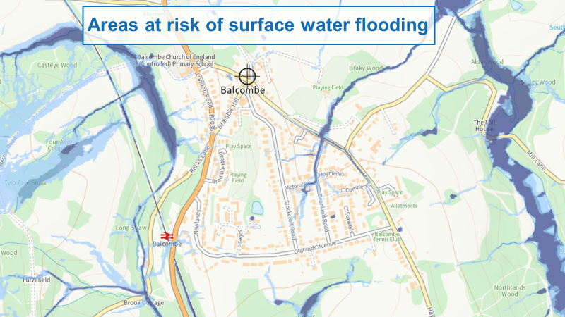
A ‘risk of flooding from surface water’ map has been produced by the Environment Agency on behalf of the government, using information and input from Lead Local Flood Authorities. It has been developed using cutting edge technology, with flood experts using models to observe how rain water flows and ponds, and producing maps that take local topography, weather patterns and historical data into account.
ttps://check-long-term-flood-risk.service.gov.uk/
An extract covering Balcombe is shown below:
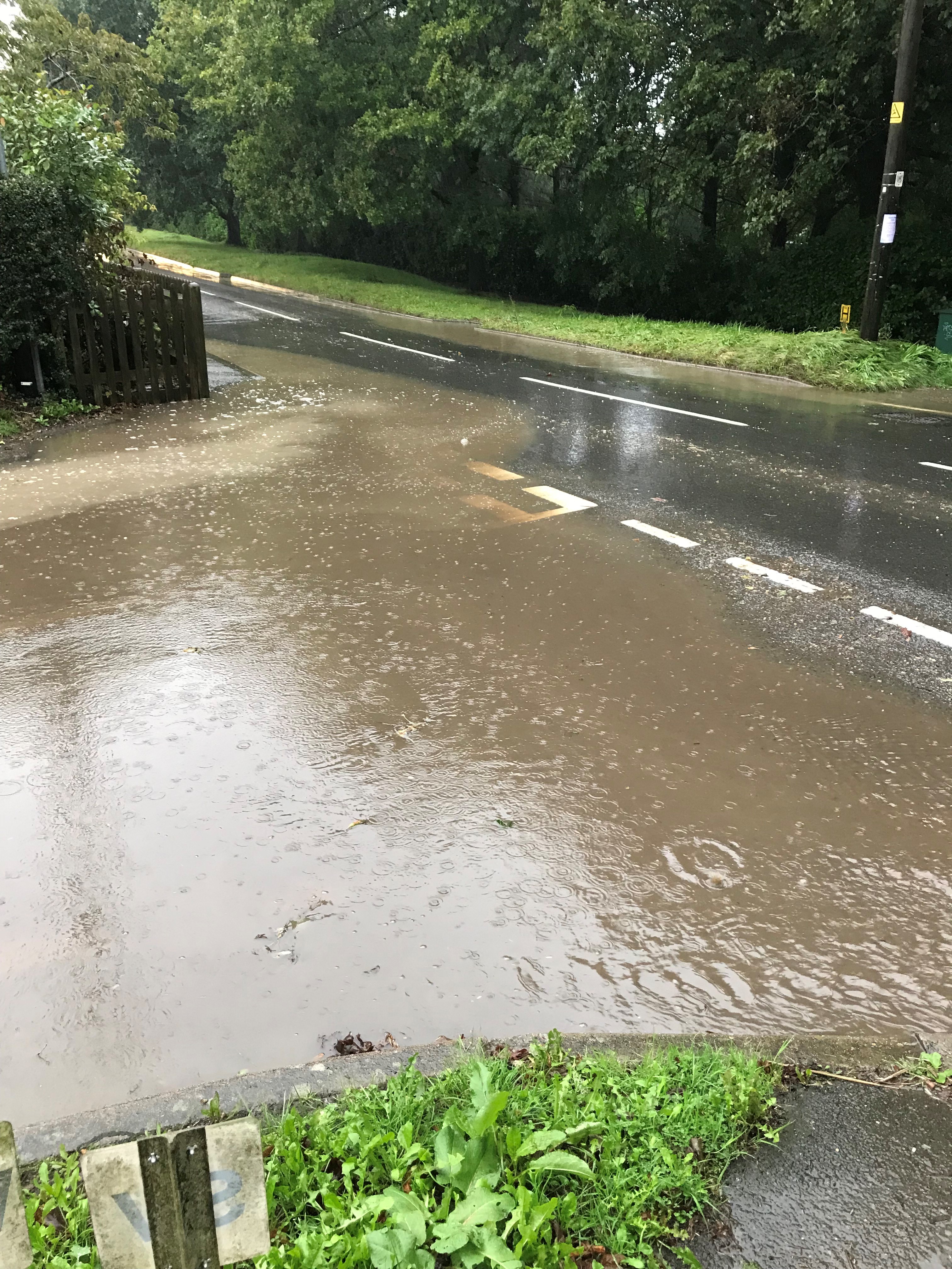
This is consistent with observations within the village when there is heavy rain, as shown below in photographs taken on 1 November 2021 at the junction of Deanland Road and Haywards Heath Road:
West Sussex LLFA Policy for the Management of Surface Water
West Sussex Council are our lead local flood authorities (LLFA) and are responsible for managing the flood risk from surface water:
Mid Sussex Strategic Flood Risk Assessment
Mid Sussex have carried out a Strategic Flood Risk Assessment:
Within the Mid Sussex Strategic Flood Risk Assessment, the following is stated about Balcombe under the section SuDS (Sustainable Drainage Systems):
Much of the area in and around Balcombe is underlain with Upper Grinstead Clay (although there are areas of Ardingly Sandstone and Lower Tunbridge Wells Sand Formation) with poorly drained soils. Minimal soakage potential is present in this area (as can be demonstrated by the number of ponds and ditches in the area) and therefore attenuation systems, such as balancing ponds, are going to be the most appropriate form of SuDS in this area. Permeable paving and other such systems can, however, be utilised so they act as source control and storage prior to a restricted discharge to a watercourse.
What can homeowners in Balcombe do?
• Rainwater butts / rainwater harvesting
• Permeable paving – driveways and patios
• Green roofs
• Rain gardens (a dip which receives run-off from roofs and other hard surfaces containing plants that can stand waterlogging for up to 48 hours. Storm water fills the depression and then drains.)
• Plant trees and hedges
Taken from:
https://www.woodlandtrust.org.uk/publications/2014/01/holding-back-the-waters/
